Case Study 1:
London : Tower Bridge Project
The brief Case Study 1: UAV Aerial survey of the property, provide Case Study 1 photographic media to building surveyor to report for prospective new owner.
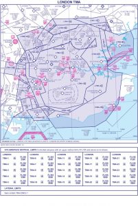
For Helidrone this was an unusual type of property survey to undertake Case Study 1. For a start, the location was fairly unusual being in London, Case Study 1 right on top of the Thames. The location itself was not in any highly restricted flying zone - Class D. However when we contacted NATS they informed us that not stray into R158. This was quite a clear borderline as crossing it meant flying over Tower Bridge and heading along Thames west and into the area of City hall, a high-security zone!
Not to mention the location is on AREA OF INCREASED RISK: HELI-ROUTE LONDON HELI-ROUTE H4
check out this map for more information: http://www.nats.aero/nsf/TMAPopup.htm
This is also another invaluable resource for UAV flights: https://www.dronesafetymap.com
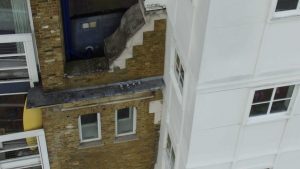
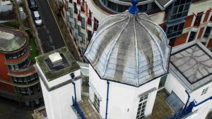
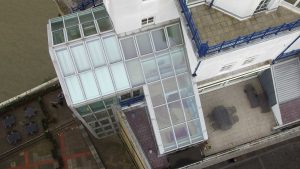
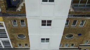
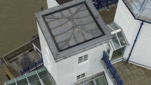
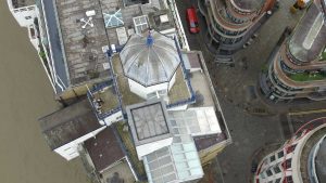
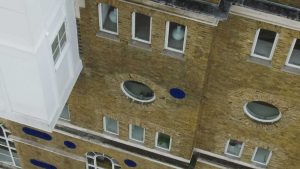
The task was to photograph and video the roof area and front side of the property which would be hard to see without the use of the drone. This is one of the great flexibilities of using a UAV. Getting access to all those inaccessible locations. How else could you get a good view from the riverside in close up detail of this location? Especially the roof area, which was not straight forward pitched roof. It comprised of various levels and details that could only be seen from acute and birds eye angles that the only a drone can fly to. There where several areas that needed attention such as gutters, pitches and flat roof areas that the on-site surveyor needs more detail of for his report writing to the potential new buyer...
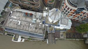
One notable situation was choosing the take-off and landing zones. This area is required to be safe enough to use (with the crew in the vicinity) and as most of the locations that were suitable on the site were surrounded by metal railing and fences there was an issue with recalibrating the compass. Something I always try to do at each location. However with perseverance. We achieved this at the end achieved as well as getting GPS reception, so we were safe to fly.
With the surveyor checking the monitor from the camera feed. We were able to achieve all the desired locations for him to write his final report, job did take a look at our other case studies: